Watch points
Clachtoll: a low shore on the Assynt coast
The lowest watching position in this register, and the one with the strangest published reason for its animals: channels cut into the seabed by ice.
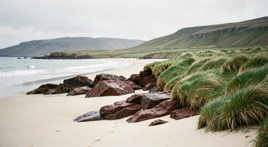
Clachtoll is not a headland and does not pretend to be. The Hebridean Whale Trail describes it as a bustling wee beach, a golden oasis within the craggy rocks of the Assynt coast, and gives the Gaelic as Clach Toll, broken rock. It is included in this register because it is the only site here that watches the mainland side of the Minch from close to sea level, and because of what the Trail publishes about the seabed offshore.
What brings the animals to a beach like this?
The published answer is the shape of the seabed, and it is the most unusual claim on any Trail page. During the last Ice Age most of Scotland was under ice, and as the ice flowed and receded it sculpted the landscape, including the sea floor. The Trail states that scientists have identified mega grooves, huge channels carved from the seabed by the ice that once covered the area off Clachtoll, and that local naturalists monitoring the whales and dolphins off this coast observe that the animals seem to follow these mega grooves, perhaps feeding along the turbulent edges of these underwater canyons.
That is an observation reported by local naturalists rather than a settled result, and this journal presents it as such. But it gives a watcher at Clachtoll something to do with a featureless sea: watch the lines rather than the whole bay.
The Trail’s list for this site
The Trail’s species list is long: bottlenose dolphins, common dolphins, minke whales, killer whales, Risso’s dolphins, harbour porpoise and basking sharks, with seals, otters, skuas, terns, black guillemots and great northern divers. Its own note is that dolphins are known to visit Clachtoll, from small groups of large bottlenose dolphins to large groups of the smaller common dolphin, and it offers the Gaelic word for dolphin, leumadair, one who leaps.
Ground and facilities
There are paths, but the Trail describes them as not all access, being slightly rough and stony, and rates the site not fully accessible. There is free parking near the Assynt Ranger’s information hut, and the walk from the car park to the water is about two minutes on path and grass. A public toilet near the car park is open April to October.
There is no public transport to the site. It is reachable by car, bicycle or on foot.
The ranger hut, and the bones
The Trail notes that the Assynt Rangers keep an information hut in the car park, full of historical and wildlife information for a visit, and that beside it lie some enormous bones from a fin whale, the second largest whale. For anyone who has spent an afternoon failing to judge the size of a distant back, standing next to a real one is a useful correction.
Just up the road
The Trail records that at Stoer Lighthouse, a short distance north of Clachtoll, dedicated local volunteers for the Whale and Dolphin Conservation Shorewatch programme can regularly be found watching. Stoer is not a Trail site in its own right, but the presence of a standardised watch nearby says something about the water.
Watching from low ground
A low shore is the hardest position to watch from, because you are looking across the surface rather than down into it, and this is the lowest watching position in this register. Everything the Sea Watch Foundation records about conditions matters more here. Its swell height categories are light under one metre, moderate one to two metres, heavy over two metres, and at Clachtoll a moderate swell alone can hide a porpoise entirely, regardless of the wind.
Against that, a low shore puts you close to animals working the inshore rocks, and a bottlenose group in a shallow bay at fifty metres does not need height to be seen. The trade is a plain one: height buys detection, low ground buys detail, and on a light swell the second is worth more here than the first.
Reading the inshore rocks
A low shore changes what you are looking for. Instead of scanning a horizon, you are working the first few hundred metres: the edges of skerries, the mouths of small bays, the tide line where water moves fast around a point. That is where a porpoise working inshore or a bottlenose group herding fish will be, and it is close enough that a sighting gives you real detail rather than a distant fin.
It also means the animals are close enough to be disturbed by what happens on the beach. The Trail’s guidance is to let the animals decide how close they want to be rather than approaching them, to avoid surrounding them, and to keep dogs under control because they scare wildlife and disrupt its daily life.
Is that rolling shape an otter or a porpoise?
On this shore, more often an otter. Otters are on the Trail’s list for this site, and they are a common source of false positives at range on a low shore: a dark rolling shape in inshore water is more often an otter than a porpoise. The separator is behaviour rather than shape, because at distance the two shapes read the same.
An otter dives head first with a visible arch and often reappears with something, close to the rocks, and it works one small area. A porpoise rolls forward showing a triangular fin and moves along the coast rather than staying put. The behaviour settles a sighting that the shape alone cannot, which is the whole reason the separator is behaviour and not outline.
Sources
The facts on this page were read back against the pages below on 5 September 2026. The Trail page carries the site itself; the Foundation form carries the swell categories.
- Hebridean Whale Trail, Clachtoll, whaletrail.org, consulted 5 September 2026.
- Sea Watch Foundation, recording form definitions, SWF/RF0.