Watch points
The Butt of Lewis: watching from the edge
The most exposed position in this register, with the widest field of view and the least shelter. Good spotting is possible without leaving the car park.
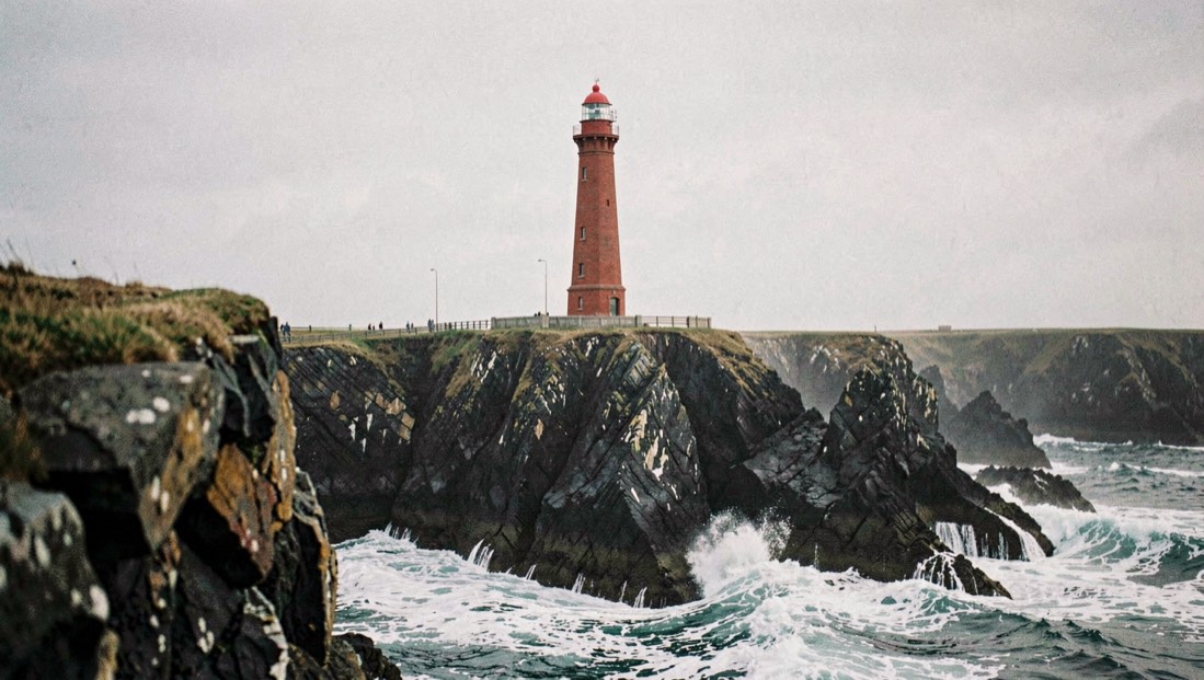
The Butt of Lewis is the top corner of the Outer Hebrides, and it offers a shore watcher something no other site here does: an almost complete circle of sea. The Hebridean Whale Trail describes the view from the base of the towering red brick lighthouse as having nearly 360 degree views across waters busy with sea life. The Gaelic name it gives is Rubha Robhanais, the point of the hole headland.
What does a 360 degree view buy you?
It buys coverage and it costs concentration. The Sea Watch Foundation’s recording forms ask a vessel based observer to state which field of view is being searched, whether 180 degrees forward, 90 degrees to one side, or all round. The discipline behind that question applies just as much on a headland. A watcher who tries to hold every bearing at the Butt will hold none of them.
The practical answer is to divide the horizon and give each part a fixed period. Ten minutes on one sector, which is the length of a standardised Shorewatch, is a reasonable unit. North and west face the open Atlantic and are where the weather arrives; east looks down the Minch towards the mainland mountains, which the Trail notes are visible on clear days.
What actually passes here?
The Trail lists Risso’s dolphins, bottlenose dolphins, minke whales, killer whales and harbour porpoises, with seals, fulmars, gannets, black guillemots and white tailed eagle. Its own description mentions seals in the waves, Risso’s dolphins travelling past the cliffs, and the splashes of gun metal grey bottlenose dolphins.
One specific record on that page is worth carrying into the field: the sea around the Butt of Lewis and down towards Tiumpan Head is recognised as an important area for Risso’s dolphin, large groups of Risso’s have been seen mixing with bottlenose dolphins, and the two species occasionally breed, producing hybrids that are hard to pick out among the rest. An animal at this site that reads as neither species cleanly may genuinely be neither.
Weather, and why it decides everything
With nothing between the cliffs and the Atlantic, this site takes the full weight of whatever is coming. The Trail’s own words are that the restless Atlantic rolls against the cliffs, sometimes bringing thunderous storms, sometimes whales and dolphins.
In detection terms that means the Butt swings across the sea state scale faster than a sheltered site. At sea state 0 to 2 it is a superb position. From sea state 4, described on the Sea Watch Foundation scale as longer waves with many whitecaps, small animals are effectively gone, and only a large blow or a tall fin will register.
The east sector is the one that connects to Tiumpan Head and to the North East Lewis Marine Protected Area, so on a day when the Atlantic side is unreadable, turning east is not giving up. It is choosing the sector the protected area was drawn around.
Seabirds as a working tool
The cliffs here hold nesting seabirds in numbers, and the Hebridean Whale Trail’s Spotter’s Guide gives the reason that matters to a cetacean watcher: seabirds often feed on the same food as whales and dolphins, so looking for a lot of seabird activity helps you work out where the animals might be.
The guide lists four other things to scan for, and they are worth carrying as a checklist. The first is dark shapes on the surface; the second is a glint where sunlight catches a surfacing back; the third is irregular splashing or odd looking waves; the fourth is smooth patches or lines on the water where something is bringing food up.
The accessible option
This is the site’s quiet advantage. The Trail rates it an outdoor site with uneven ground and steep cliffs, but notes that there is good spotting from the car park, and therefore good accessibility for whale watching. A watcher who cannot manage broken clifftop ground is not excluded here, which is not true everywhere on this coast.
Ground and safety, as published
The Trail describes open access but uneven ground, and warns to take care on the cliffs, that the grass is very slippery when wet, and to avoid anywhere near the edge of the crumbling cliffs.
There are no facilities at the site itself. Service bus W1 runs every few hours and passes the end of the road to the Butt, leaving a walk of about a mile.
Access and respect
Scottish access rights apply here, and the Trail asks visitors to follow paths near houses, farms and crops, and to keep a safe distance from cattle and sheep on common grazings. It asks visitors never to walk between young animals and their parents, to use gates and leave them closed, and to take all litter away. Several sites on the Trail sit on croft land in active use.
Nearby, per the Trail
Public facilities are at Sporsnis, the community sports and recreation centre in the nearby villages, which the Trail notes carries a display on the local natural environment. Cafes and pubs are in the villages rather than at the headland.
Sources
The facts on this page were read back against the pages below on 5 September 2026.
- Hebridean Whale Trail, The Butt of Lewis, whaletrail.org, consulted 5 September 2026.
- Hebridean Whale Trail, Responsible Access, consulted 5 September 2026.
- Sea Watch Foundation, recording form definitions, SWF/RF0.